Current MSc & PhD postgraduates
Geomatics Division postgraduate candidates
| Candidate | Postgraduate Degree | Supervisor | Research Topic |
|---|---|---|---|
|
Ms Dianah Abeho 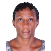
|
PhD |
Dr Moreblessings Shoko
Co-supervisor: Associate Professor Patroba Odera |
Automated cadastral mapping of customary land using unmanned aerial vehicle imagery in Uganda |
Ms Melissa Akoue Mve

|
MPhil | Professor Jennifer Whittal |
Preliminary topic: The suitability of the New Zealand e-cadastral reform for the South African context. |
|
Mr Ernest Akum 
|
PhD |
Dr Siphiwe Mphuthi | Integrated Water Resource Management for River Basin/Agricultural Watersheds Considering Climate Change Impacts. A Case Study: The Limpopo River Basin, South Africa |
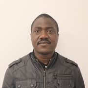
Mr Azeez Alade
|
PhD | Associate Professor Patroba Odera | Towards establishment of a vertical datum for Nigeria based on a precise gravimetric geoid model |
Mr Garner Brown

|
MSc Engineering (Geomatics) | Associate Professor Patroba Odera
Co-supervisor: Dr Moreblessings Shoko |
Understanding surface dynamics of the Fimbul ice shelf using Geospatial techniques |
Mr Brighton Chamunorwa

|
PhD | Dr Moreblessings Shoko | Coupling machine learning-based mapping and simulation models for evaluating the mediating role of informal settlements between runoff and stormwater quality |
Mr Mboyonga Kaputula

|
PhD | Professor Jennifer Whittal | Assessing the impact of fit for purpose tools on traditional cadastral methods and systems: A Case of Lusaka, Zambia |
Mr Jacques Lombaard

|
MSc Engineering (Geomatics) | Dr Moreblessings Shoko | Integration of Geomatics and Geotechnical methods for hazard monitoring |
Ms Relebohile Mabathoana

|
MSc Engineering (Geomatics) | Mr Kaveer Singh | Enhancing urban stormwater management in the City Of Cape Town: Integrating aesthetic features and green infrastructure for sustainable water management and socioeconomic impact |
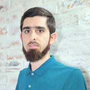
Mr Hassan Mahomedy
|
MSc Engineering (Geomatics) | Associate Professor Patroba Odera | An assessment of the spatial-temporal land use/cover dynamics and related impacts in major mining areas, South Africa |
Mr Medupi Malema

|
MSc Engineering (Geomatics) | Dr Siphiwe Mphuthi | Site selection and feasibility analysis for the development of Solar Photovoltaic (PV) plants in South Africa |
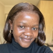
Ms Sinelizwi Malindi
|
MPhil | Dr Siphiwe Mphuthi | Cape Town's future population growth to project the needs for public services |
|
Mr Thobani Maluleka
|
MSc Engineering (Geomatics) |
Dr Siphiwe Mphuthi |
inSAR time-series analysis and susceptibility mapping for land subsidence monitoring in Cape Town, South Africa |
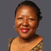
Ms Pamela Masiko-Kambala
|
PhD | Associate Professor Simon Hull | The persistence of informal property sales in Cape Town’s state-subsidised housing sector: causes and consequences |
Ms Nokubonga Mfeka

|
MSc Engineering (Geomatics) | Dr Siphiwe Mphuthi | Investigating innovative methods and mechanisms for updating topographic features |
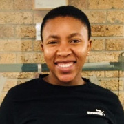
Ms Flassie Mpanza
|
MSc Engineering (Geomatics) | Dr Siphiwe Mphuthi | GIS Analysis of school distribution in Eastern Cape |
Mr Sanele Mteshane

|
MSc Engineering (Geomatics) | Associate Professor Simon Hull | Optimal Site Selection for Renewable Energy Plants in Ugu District Municipality Using Geospatial Techniques |
Ms Itumeleng Musa

|
MSc Engineering (Geomatics) | Associate Professor Warren Smit | Monitoring the physical form of informal settlements formed during the Covid-19 pandemic using remote sensing: The case study of Spine Road informal settlement, Khayelitsha |
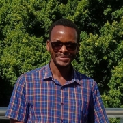
Mr Elly Ngailo
|
PhD | Associate Professor Patroba Odera
Co-supervisor: Associate Professor D. Sarah Stamps |
Crustal deformation monitoring of Victoria, Masai and Rovuma micro-plates in Tanzania using geodetic and geophysical techniques |
Mr Simphiwe Ngubane

|
MSc Engineering (Geomatics) | Associate Professor Simon Hull | The locational potential of offshore wind renewable energy and the role that coastal Special Economic Zones (SEZs) play as drivers or restrictors to its adoption |
Mr Siyamthanda Nyembezi

|
MSc Engineering (Geomatics) | Associate Professor Simon Hull | Plot power and promises, policy making at the land energy nexus |
Mr Handsome Bongani Nyoni

|
PhD | Dr Moreblessings Shoko | Development of an Integrated Composite Indicator for Mapping Particulate Matter2.5 in Sub-Saharan Africa |
Mr Siphesihle Radebe

|
MSc Engineering (Geomatics) | Dr Siphiwe Mphuthi | Quality Assessment of UAVs-Based Topographic Mapping |
Mr Richard Ribbans

|
MSc Engineering (Geomatics) | Dr Moreblessings Shoko
Co-supervisor: Associate Professor Patroba Odera |
3D modelling of the Fimbul Ice Shelf face - An internal and external geometry perspective |
Mr Abdulganiy Ola Shittu

|
PhD | Associate Professor Patroba Odera
Co-supervisor: Associate Professor Walyeldeen Godah |
Integrated determination and analysis of crustal deformation using GNSS, InSAR and gravity data. A case study of Ifewara/Zungeru faultline in Nigeria. |
Mr Kaveer Singh

|
PhD | Associate Professor Warren Smit
Co-supervisor: Associate Professor Patroba Odera |
Modelling land use change in townships of Cape Town |
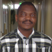
Mr Sydney Togarepi
|
PhD | Associate Professor Patroba Odera
Co-supervisor: Dr David Siriba |
Developing quality assessment tools for Volunteered Geographic Information data |
Ms Simone Vieira

|
MSc Engineering (Geomatics) | Dr Simon Hull (Geomatics)
Professor Roger Behrens (Civil Engineering) |
A spatio-temporal and association analysis of road traffic crashes at road intersections in the City of Cape Town Municipality |
Mr Alex Yumbu

|
PhD | Associate Professor Patroba Odera
Co-supervisor: Professor Sebastian Skatulla |
The spatial dynamics of Fimbul Ice Shelf from integrated terrestrial and space geodetic data |
Ms Kumbirai Zingore

|
PhD | Professor Nancy Odendaal and Dr George Sithole | Modelling the spatial distribution and spread of the invasive peach fruit fly Bactrocera zonata (Saunders) (Diptera: Tephritidae) under changing climate regimes |
Mr Sphamandla Zungu

|
MSc Engineering (Geomatics) | Dr Siphiwe Mphuti
Co-supervisor: Dr Anita Campbell |
Identifying Spatial Disparities in University Success - A GIS and Remote Sensing Approach for 1st year students entering Engineering Mathematics at UCT |